Etosha National Park: History & Culture
Discover Etosha National Park
Quick facts
- Size: 22,270 km²
- Protected since: proclaimed a game reserve in 1907 by governor Friedrich von Lindequist; national park status since 1967
- Location: northwestern Namibia, spanning parts of the Kunene, Oshana, Oshikoto and Otjozondjupa regions
- Wildlife: about 114 mammal species, 340 bird species, 110 reptile species
- Main camps: Okaukuejo, Namutoni and Halali
- Visitors: roughly 200,000 a year (2010 estimate)
A pan you can see from orbit
The Etosha Pan itself covers about 5,000 km² — roughly 130 km long — and makes up 23% of the park. It is usually a cracked, shimmering white salt flat, filling briefly with water after summer rains and drawing flocks of pelicans and flamingos when it does. The pan’s scale is what gives Etosha its name, an Ovambo word usually translated as ‘great white place’.
Wildlife and conservation
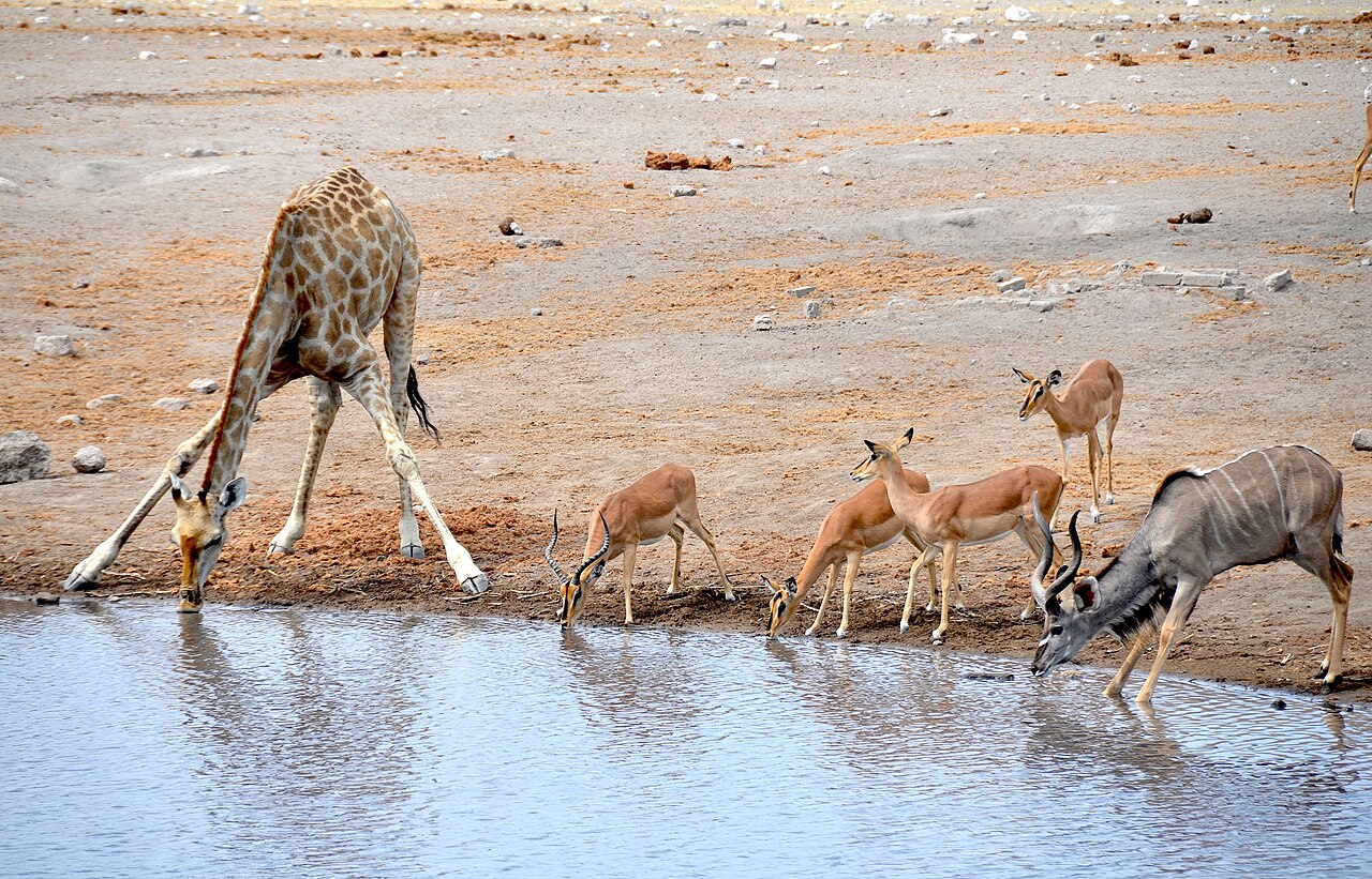
Etosha is one of southern Africa’s most reliable places to see lion, elephant, leopard and the critically endangered black rhino, concentrated around waterholes that make game-viewing unusually easy for a self-drive park. The Leopard Hills area in the park’s east, known locally as Ondundozonananandana, is noted for an especially high density of leopards, and the black-faced impala — listed among the park’s common antelope — is one of Etosha’s more distinctive residents. That same concentration of rhino has made Etosha a poaching target: 46 rhino were killed in the park in 2022 alone, and anti-poaching patrols are an active, ongoing part of park management — a reminder that rhino sightings and their locations are best not shared publicly while travelling. The Etosha Ecological Institute, founded in 1974 and based at Okaukuejo, carries out the park’s research into these pressures.
Two century-old forts turned rest camps
Both of Etosha’s oldest camps began as German colonial military posts on the ‘Red Line’, a veterinary control boundary drawn in 1896 between Okaukuejo and Otjituuo to separate livestock disease zones. Namutoni’s fort was first built in 1896 as a police post, then destroyed on 28 January 1904 when around 500 fighters under Nehale Mpingana attacked and overran the garrison — part of the wider Herero and Nama resistance to German rule. The Germans rebuilt it, and it later held English prisoners during the First World War before passing through police and South African military use. Declared a national monument in 1947 and restored to its current form in 1957, the fort is Namutoni’s centrepiece today, though newer accommodation now stands alongside it. Okaukuejo, at the park’s western entrance, keeps a round watchtower from a German fort built around 1901, and its illuminated waterhole — visible from camp after dark — is one of Etosha’s signature wildlife-viewing spots, regularly drawing elephant, lion and black rhino into view at night.
Getting there
Andersson Gate, on the park’s southern boundary near dolomite hills, is the main entrance for visitors arriving from Windhoek and Outjo, close to Okaukuejo camp, about 650 km from Windhoek by road. Namutoni, with its restored German colonial-era fort, anchors the eastern side of the park nearer Tsumeb and Ondangwa. Roads inside the park are gravel and well maintained in the dry season; fuel is available at Okaukuejo, Namutoni and Halali, but distances between fuel stops elsewhere in Namibia can be large, so travellers should top up whenever they pass a station.
Where to stay
Namibia Wildlife Resorts runs rest camps at Okaukuejo, Namutoni, Halali and Dolomite inside the park, each with camping, cottages or rooms, a restaurant, bar, swimming pool and a shop for provisions and firewood, and each built around its own floodlit waterhole. Just outside Andersson Gate, Etosha Safari Lodge (Gondwana Collection) is a well-reviewed, more affordable base — see our Etosha Safari Lodge stay page. Private reserves bordering the park’s south and west, such as Ongava, offer higher-end lodges with guided game drives, including night drives not permitted inside Etosha itself.
Planning your visit
Self-driving between camps is straightforward on the park’s gravel road network, but each camp’s waterhole is really the reason to overnight inside the park rather than just passing through on a day trip: predator sightings after dark, especially at Okaukuejo, are hard to match anywhere else in Namibia. Given the park’s size, most visitors base themselves at two or three camps across a stay of several days rather than trying to see all of Etosha from one base.
Self-drive note: fuel and water reserves matter in this part of Namibia — carry spares and plan routes around service stations, per general Namibian self-drive guidance.
Frequently asked questions
How big is Etosha National Park?
Etosha covers 22,270 km², built around the Etosha Pan salt flat, which covers about 5,000 km² — roughly 23% of the park.
Which camps are best for game viewing at Etosha?
Okaukuejo, Namutoni, Halali and Dolomite are the main rest camps, each built around its own floodlit waterhole for night viewing. Okaukuejo and Namutoni both began as century-old German colonial forts.
Is Etosha good for a self-drive safari?
Yes. Roads inside the park are gravel and well maintained in the dry season, and the waterholes concentrate wildlife, making sightings unusually easy for self-drivers compared to denser bush parks.
What wildlife can I see at Etosha?
About 114 mammal species, including lion, elephant, leopard and the critically endangered black rhino, plus 340 bird species. The Leopard Hills area is known for an especially high leopard density.
How do I get to Etosha National Park?
Andersson Gate, on the southern boundary near Okaukuejo camp, is the main entrance for visitors from Windhoek — about 650 km by road. Namutoni anchors the eastern side of the park, closer to Tsumeb and Ondangwa.
About the author
Makume Toti is a digital marketing veteran with 15+ years of cross-vertical experience and a 12-year foundational career in the airline industry. He leverages his extensive insider knowledge of travel and enterprise SEM & AIO expertise to curate authoritative guides to Southern Africa for ExploreMzansi.
Etosha Pan, Okaukuejo waterhole, Namutoni Fort, Halali, black rhino tracking